
By Miriam Raftery
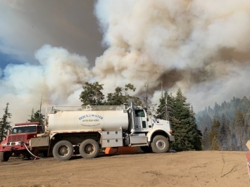
Photo: Local water tender contractor Richard Edwords of Alpine is in Covelo helping to battle the August Complex Fire, which at over 1 million acres is now the largest fire in California history.
October 5, 2020 (San Diego) – At 2 million acres, California’s all-time record for wildfire devastation in a single year was shattered last month. Now that figure has more than doubled, with over 4 million acres scorched so far in 2020 by over 8,300 wildfires.
More than 16,600 firefighters continue to work towards containment on 23 major wildfires and one extended attack wildfire across the state. Yesterday, firefighters also responded to 26 new wildfires, bringing full containment to all but one, the Lambert Fire in Amador County. But many large, older fires continue to rage as the devastating toll grows.
To date, the total number of fatalities statewide from wildfires this year is 31 and over 8,687 structures have been destroyed.
Temperatures will remain warm today across the state and humidity recover remains slow, continuing the increased fire danger. More seasonal temperatures are expected by the end of the week, with a chance of some precipitation in the most northern part of the State. Locally gusty winds continue over the next few days on the west edge of the Sacramento Valley, the North and East Bay, and Southern California mountain ranges.
While President Donald Trump has blamed the state's severe fires on not "raking" or "clearing" forests, nearly all of California's forest lands are owned by the federal government or are on private lands, with only a small fraction on state-owned property. Moreover, many of the most devastating fires have occurred even in urban and coastal areas once though safe from firestorms, but scientists and fire officials warn that climate change has caused hottier, drier conditions and virtually year-round fire season now that is straining resources and devastating communities statewide.
California historically experiences some of the most devastating wildfires in the months of September and October. Cal Fire warns, “Do not let your guard down! “ To learn more ways to prevent sparking a wildfire visit www.ReadyForWildfire.org.
Below are updates on the major fires statewide, courtesy of Cal Fire”
Fires of Interest:
**CAL FIRE Incidents**
Zogg Fire, Shasta County (more info…)
Southwest of Redding
*56,305 acres, 76% contained
*4 Fatalities
*Evacuation orders in place
*CAL FIRE Team 2 in command
Glass Fire, Napa and Sonoma County (more info…)
4 miles east of Calistoga
*65,580 acres, 30% contained
*Evacuation orders in effect and additional evacuations in progress
*CAL FIRE Team 3 in command
Butte/Tehama/Glenn (BTU/TGU) Lightning Complex, multiple Counties (more info…)
Butte, Tehama and Glenn Counties
*19,609 acres, 97% contained
*14 structures destroyed
*While no growth is expected, fire suppression repair work is ongoing.
**Unified Command Incidents**
Martindale Fire, Los Angeles County (more info…)
Bouquet Canyon, Northeast of Santa Clarita
*230 acres, 98% contained
*Unified Command USFS and Los Angeles County FD
Creek Fire, Fresno County (more info…)
Northeast of Shaver Lake (Sierra National Forest)
*322,089 acres, 48% contained
*Evacuations in place
*Heavy tree mortality in the area
*852 structures destroyed
*CAL FIRE Incident Management Team 1 in unified command with USFS Great Basin Team 1
SQF Complex, Tulare County (more info…)
3 miles east of Giant Sequoia National Monument
*158,058 acres, 65% contained
*Evacuations in place
*232 structures destroyed
*CAL FIRE Incident Management Team 6 in unified command with USFS Team 2
**Coordinated Command Incidents**
August Complex, multiple Counties (more info…)
Colusa, Glenn, Lake, Mendocino, Tehama and Trinity Counties
Elk Creek and Stonyford area (Mendocino National Forest)
*1,002,097 acres, 54% contained
*South Zone 543,114 acres
*North East Zone 260,078 acres
*North West Zone 64,069 acres
*West Zone 134,836 acres
*1 fatality
*159 structures destroyed
*Includes multiple fires including the Elkhorn, Hopkins, Willow, Vinegar, and Doe fires
*Pacific North West Team 2 in command of the South Zone
*Alaska Incident Management Team 1 is in command of the North Zone
*CAL FIRE Incident Management Team 5 is in unified command on the West Zone
**Federal Incidents**
North Complex, Plumas County (more info…)
Northeast of Oroville to southwest of Quincy (Plumas National Forest)
*318,724 acres, 83% contained
*15 fatalities
*2,342 structures destroyed
*Evacuations in place
*Includes the Bear and Claremont Fire
Snow Fire, Riverside County (more info…)
Snow Creek Rd, west of Palm Springs
*6,254 acres, 95% contained
El Dorado Fire, San Bernardino County (more info…)
West of Oak Glen (San Bernardino National Forest)
*22,744 acres, 93% contained
*1 fatality
*10 structures destroyed
*California Interagency Incident Management Team 13 in command
Slater Fire, Siskiyou County (more info…)
5 miles North of Happy Camp (Klamath National Forest)
*155,096 acres, 62% contained
*2 fatalities
*Evacuation orders in place
Devil Fire, Siskiyou County (more info…)
5 miles north of Upper Devil’s Peak (Klamath National Forest)
*8,631 acres, 27% contained
Bobcat Fire, Los Angeles County (more info…)
North of Duarte (Angeles National Forest)
*115,758 acres, 88% containment
*Evacuations in place
Dolan Fire, Monterey County (more info…)
Hwy 1, 10 miles south of Big Sur (Los Padres National Forest)
*124,924 acres, 91% contained
*Structures threatened
*California Interagency Incident Command Team 15 in command
Bullfrog Fire, Fresno County (more info…)
SE of Bullfrog Lake (Sierra National Forest)
*1,185 acres, 50% contained
Fork Fire, El Dorado County, (more info…)
15 miles northeast of Pollock Pines (El Dorado National Forest)
*1,667 acres, 70% contained
Apple Fire, Riverside County (more info…)
Oak Glen/Cherry Valley (San Bernardino National Forest)
*33,424 acres, 95% contained
Red Salmon Complex – Humboldt County (more info…)
14 miles northeast of Willow Creek (Shasta-Trinity National Forest)
*132,065 acres, 34% contained
Blue Jay Fire, Mariposa County (more info…)
Yosemite National Park Wilderness
*5,335 acres, 50% contained
Wolf Fire, Tuolumne County (more info…)
Yosemite National Park Wilderness
*1,092 acres, 60% contained
Slink Fire, Mono County (more info…)
2 miles west of Coleville (Humboldt-Toiyabe National Forest)
*26,759 acres, 86% contained
Moraine, Tulare County (more info…)
Sequoia and Kings Canyon National Parks Wilderness
*694 acres, 70% contained
Rattlesnake, Tulare County (more info…)
Sequoia and Kings Canyon National Parks Wilderness
*4,471 acres, 30% contained
**Extended Attack**
Lambert Fire, Amador County
7 miles southeast of Rancho Murieta
*21 acres, 10% contained
Top 20 Wildfire Records
- 5 of the Top 20 largest wildfires in California History have occurred in 2020.
- Largest Wildfires - #1 August Complex, #3 SCU Lightning Complex, #4 LNU Lightning Complex, #5 North Complex, and #6 Creek Fire.
- Most Destructive - #5 North Complex, #10 LNU Lightning Complex, #11 CZU Lightning Complex, #13 Glass Fire and #17 Creek Fire.
Deadliest Wildfires - #5 North Complex and #16 LNU Lightning Complex.


Recent comments