
East County News Service
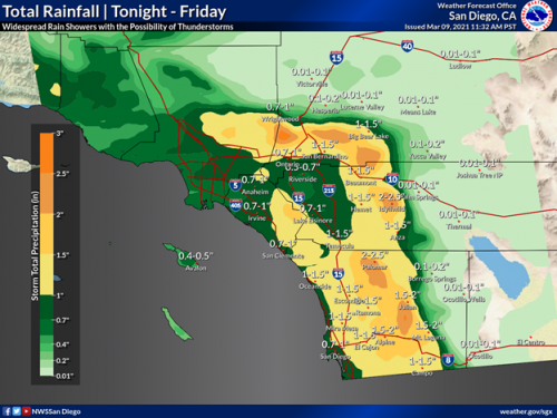
March 10, 2021 (San Diego’s East County) – A multi-day storm is expected to continue today through Friday, with chilly temperatures and heaviest rainfall today. Snow could drop as low as 3,500 feet tonight and tomorrow, the National Weather Service predicts.
Treacherous travel and traffic delays are possible through mountain passes, including on I-8 in San Diego’s East County and I-15 in Riverside County due to freezing conditions and reduced visibility in snow and fog. Winds with gusts up to 60 miles per hour could bring damage to temporary structures such as tents and canopies.
There is a chance of thunderstorms as well Wednesday through Friday, with lightning and hail possible at the beach areas, where high surf is also expected.


Recent comments