
By Miriam Raftery
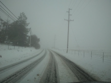
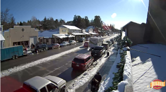
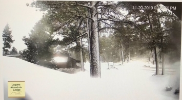
November 23, 2019 (San Diego’s East County) – If you’re heading over the rivers and through the woods this Thanksgiving week, you might just wind up traveling through white and drifted snow, as the popular song lyrics go—not to mention rain and flash flooding, too, making for hazardous roadway conditions across southern California, the National Weather Service warns.
The National Weather Service predicts a major winter storm will bring significant snowfall of one to two feet above 5,000 feet by Wednesday, with the snow level dropping to 3,000 feet or even lower by Friday. Snow could impact I-8 through San Diego County’s mountains, as well as areas such as Cuyamaca, Julian, Jacumba Hot Springs, Descanso, Mount Laguna and Palomar Mountain locally, as well as the Cajon Pass on I-15 for those heading north.


 East County News Service
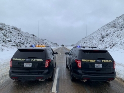
 By Miriam Raftery
 East County News Service
 Waterspouts possible in coastal areas


Recent comments