
 By Karen Pearlman, with photos by Karen Pearlman and Miriam Raftery
Feb. 22, 2026 (San Diego County) -- With an early wildflower bloom in Borrego, now is a perfect time for a day trip through San Diego County’s beautiful backcountry, including mountain and desert destinations.
Making the pilgrimage to the destination that is the Anza-Borrego Desert area can also include stops along the way there, and back, especially if you take a different way to your starting point.
When you arrive, the park has two visitor centers where you can get wildflower maps and information on current wildflower blooms, trails and more. The the main visitor center is at the Anza-Borrego Desert State Park’s headquarters at 200 Palm Canyon Drive but there’s also one inside a shop on Christmas Circle in Borrego Springs at 587 Palm Canyon Drive.
Two two-legged friends, one four-legged sidekick and I decided to punt the Super Bowl and its advertisements out of the endzone and instead make our way from San Diego to on a journey to Borrego Springs, a location 78 miles southeast of San Diego.

On our travels, we also hit several other spots in and around the Anza-Borrego Desert State Park – all of which brought us unexpected wildlife (especially at Lake Cuyamaca), roadside oddities (don’t miss Ricardo Breceda’s stunning metal sculptures of dinosaurs and other long ago desert denizens), sweet apple pie (Julian’s famous for ’em) and beautiful, floral-infused landscapes (hello, all of Borrego).
Because we had a dog with us, and State Parks forbid canines on its trails, the Anza-Borrego Desert State Park itself was a no-go on this trip. Dogs are also prohibited in the flower fields. But if you don’t bring a dog, hikes along several trails are a must -- not just for wildflowers, but also for a better opportunity to see those Borrego Bighorn sheep.
Morning has broken
The early-morning drive toward Ramona and Santa Ysabel felt like an exhale from city life, with rolling hills providing green space and farmland, and we saw plenty of cows, goats, sheep and horses.
 Of course, once you’re in Santa Ysabel, the unwritten rule is a stop at Dudley's Bakery for some sweets and a loaf or five of the famous Dudley’s bread -- all the better to prepare us for the day awaiting.
Just before we hit the drop of the Montezuma Grade, we looked for the familiar Yeti statue as we passed through the tiny town of Ranchita.
The 11-foot-tall, 300-pound Fiberglas white monster called “Rancheti” has also been dubbed the “Abominable Sandman of Borrego.” He continues to stand watch over the remnants of neighboring Montezuma Valley Market, which burned down in 2021.
The views coming down the big hill of S22 are still otherworldly. A closer look showed the Ocotillo not quite ready for prime time. None had started blooming their signature red-orange blossoms. But truly, the only disappointment was not spotting any Peninsular Bighorn sheep on any of the granite boulders or amongst the cacti.
We didn’t stop at the Montezuma Valley Road Lookout (2,300 feet high above sea level) on this day, but others were pulled over checking out the views. The views on a clear day like the one we had include the Anza-Borrego Basin, the Salton Sea and Superstition Mountain Off-Highway Vehicle Area.
Did you know?
Montezuma Valley Road drops about 3,300 feet in a 10-mile span and was built by local prisoners in the 1950s and ’60s.
Our driver navigated the steep descent like a champ in her trusty Toyota sedan. As we hit the desert floor, however, daredevil drivers all but demanded our attention.
Since we had a dog with us, hikes were not the order of the day, but at least two of us have fond memories of trails we have traversed in the past.
Some of the better-known hikes in the area include:
Borrego Palm Canyon: Though part of it is currently closed, this is the crown jewel of regional hikes. Located at the northern end of Palm Canyon Drive, just past the Park Visitor Center, this trail is the park's most popular destination. The iconic three-mile round-trip trek climbs 700 feet through rugged terrain. While the palm grove itself remains closed for post-fire recovery, the 1.5-mile mark offers a stunning overlook where hikers can witness the desert’s remarkable ability to regenerate.

Coyote Canyon: Accessed at the northern end of Di Giorgio Road, this area is one of the few places in the park with year-round flowing water. While the lower canyon is accessible to many, reaching the upper reaches requires a sturdy 4WD to navigate sandy washes and rocky crossings, offering a lush contrast to the surrounding parched peaks.
Hellhole Canyon: Situated just west of S-22 (Montezuma Valley Road) at the base of San Ysidro Mountain, this trail is a rugged alternative to the more crowded Palm Canyon. The path follows a seasonal stream to Maidenhair Falls, a delicate desert waterfall framed by moss and ferns.
Narrows Earth Nature Trail: Found right off Highway 78 in the central part of the park, the gentle half-mile walk offers a lesson in earth science. In just 30 minutes, hikers can observe the dramatic evidence of fault lines, flash floods and seismic shifts that have shaped canyon.
Cactus Loop Nature Trail: A spiny botanical road positioned directly across S-3 (Yaqui Pass Road) from the Tamarisk Grove Campground, this one-mile loop offers a short but strenuous climb. The uneven surface rewards the focused hiker with a dense variety of desert cacti and elevated views of the San Felipe Wash.
‘Ehmuu-Morteros Trail: Deep in the heart of Blair Valley, accessed via a dirt road off S-2 (Great Overland Stage Route), the half-mile walk serves as a portal to the past. The trail winds through a seasonal Kumeyaay village site, where grinding holes (morteros) in the granite boulders remain as silent witnesses to centuries of history.
Yaqui Well Nature Trail: Starting across the road from the Tamarisk Grove Campground at the junction of Hwy 78 and S-3, this 1.5-mile one-way trail leads to a historic desert watering hole. It is a favored spot for local birdwatchers; hikers can return the same way or follow the Primitive Camp road to complete a loop through the desert scrub.
The Slot (see photo, below right): A narrow adventure best for those who don’t have claustrophobia, it is a few miles east of Borrego Springs, hidden off Buttes Pass Road, a dirt turn-off from Highway 78. You navigate a path that narrows to shoulder-width beneath towering, wind-carved walls, in a labyrinth hike.

Font’s Point: This offers the grand view, and is reached via a four-mile sandy wash off S-22 (Borrego Salton Sea Way). The overlook is often called the "Grand Canyon of San Diego." While the drive requires a steady hand, the short walk to the cliff’s edge provides a breathtaking vista of the corrugated Borrego Badlands.
Wind Caves: Tucked away in the Fish Creek Area off Split Mountain Road, these sandstone formations are a geological marvel. The trail climbs through a wash to reveal deep, wind-eroded pockets in the bluffs, offering a panoramic view of the vast Carrizo Badlands to the south.
Elephant Tree Nature Trail: Tucked away off Split Mountain Road south of Ocotillo Wells, this one-mile level loop requires a high-clearance, 4-wheel drive vehicle to reach the trailhead. It highlights the bizarre, thickened trunks of the rare Elephant Tree, showcasing the extreme biological adaptations necessary to thrive in the arid basin.
Speaking of 4WDs…
As we made our way along the roads outside of the Park, we were intrigued by other vehicles just off the side of the main drag.
We skirted the edges of Ocotillo Wells State Vehicular Recreation Area, where the desert transforms into a playground for dune buggies, motorcycles and modified 4x4s.

We pulled into a spot near an official Ocotillo Wells sign to get a closer look. There, all sorts of vehicles sped by us on unmarked desert roads and raced up and down the steep faces of the mountains surrounding us.
Flower fields
Arriving in the heart of Borrego Springs, the roar faded and the flowers grabbed our attention.
While not a historic superbloom year (at least not yet), the desert is starting its annual floral show, especially along Henderson Canyon Road. The sides of the road called us over to admire and photograph the beauty.
The flowers looked like they were painted with broad strokes of bright yellow brittlebush, delicate white dune evening primrose, and vibrant splashes of purple sand verbena and lupine.

The backdrop of the Santa Rosa Mountains -- which separate the Borrego Valley from the Coachella Valley -- cutting into the blue sky with just a few clouds made it literally picture perfect.
Staying alert and aware
We found out the hard way that while the allure of the flowers is strong, the shoulders of desert roads can be treacherous. The dirt and sand there is deceptive.
Despite new tires and a strong foot to the accelerator, the car and the four of us inside it nearly got stuck in it while stopping to admire views in Borrego’s badlands. Only a strong final surge of power on the gas pedal while twisting the steering wheel prevented a call to a towing service.
Stalking statues
Proudly welcoming and eclectic, Borrego Springs is equally an artist’s haven.
Our first mission was hunting the beasts: the incredible metal sculptures of Ricardo Breceda. These massive, rust-colored installations appear like mirages coming out of nowhere when seen from afar.

We pulled close to several. We stood beneath towering prehistoric mastadons, a camel and one incredible 350-foot-long sea serpent undulating through the sand.
There was also a bronze Jeep (see photo above) created atop a rock pile to bring to life the vibe of the driver and passenger climbing up some boulders. Others depict giant dinosaurs.
We also made a point to see the "Pilot House" near the Borrego Valley Airport.
The house (see photo, below right) is an architectural curiosity built by financial guru, longtime Southern Californa disc jockey and author Gabriel Wisdom. It’s a striking, modern structure.

Though not open for tours, Wisdom rents out the house, which looks like it landed from orbit, for visitors.
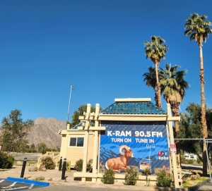
Afterward, we cruised through the main drag/roundabout Christmas Circle, and made a quick visit to new local radio station, K-RAM 90.5 FM, which at that time was just a few days from broadcasting live from the heart of the roundabout in the old Wells Fargo building. It has since been on-air to rave reviews.
Feeding the beasts
Hungry and hot, we headed to the historic luxury resort La Casa del Zorro for lunch.
 The hotel with its casitas (some with their own hot tubs) is a true oasis with a beautiful swimming pool and aesthetically pleasing architecture. Its restaurant offers cool drinks (including a dog water bowl) and excellent food amidst roses and other greenery.
 There were even a few vegetarian options on the menu.
As another side consumer note, we also hit the DG (Dollar General) Market, which opened in 2020. Since there aren't any DG Markets in San Diego County, we took the opportunity to stock up on “supplies” (candy bars, potato chips, more water and sodas) while marveling at the selection in this desert outpost.
With the afternoon waning, we took the legendary Banner Grade (Highway 78) back up toward Julian. This road is an engineering marvel of switchbacks, offering dizzying views as the desert shrinks in the rearview mirror.
We noted on the way that there is also a place to stay that is pet friendly at Banner Ranch, but we did not stop there.
The ‘B’ and the ‘K’
Heading toward Julian we spotted the giant letters “B” and the “K” emblazoned on the side of the mountains along the road and thanks to Google learned that the letters are sort of a wink-nod for backcountry residents.
The letters are neighborhood identifiers – the “B” marking the boundaries of the Banner Grade community, and the “K” standing for the Kentwood-in-the-Pines subdivision closer to Julian.
Landing in the mountain hamlet, daylight was becoming scarce so we made quick stops for to-go signature apple pies at both Julian Pie Company and Mom’s Pie House, which because of the Super Bowl, were not jam packed.
To be sure, the intoxicating scent of cinnamon and baking apples remains the primary reason visitors flock to this historic mountain hamlet, but Julian’s true charm lies in the slow pace of its walkable thoroughfares and collection of "mom and pop" storefronts.
The independent boutiques – most housed in 19th-century brick and timber buildings -- offer everything from handmade soaps and vintage antiques to locally sourced honey. We also saw some beautiful roadside daffodils (see photo, below right).

Julian has an annual Daffodil Festival every March, too.
If time is not an object, a trip to the Eagle Mining Company is a kick. Located just a few blocks from the town center, this preserved gold mine offers guided tours and an authentic look at the 1870s gold rush that put Julian on the map.
There are also several lodging opportunities tucked away on the hillside, from cozy, Victorian-style bed and breakfasts to the storied Julian Gold Rush Hotel.
Despite all the history, walkability and hospitality offerings of Julian, we wanted to make it to Lake Cuyamaca https://www.lakecuyamaca.org/ before sunset. But before we left, we headed toward Menghini Winery to see if we could spot some locals – wild turkeys – on the premises.
And we did – spotting several groups in a couple of different fields on the way to the winery.
Lake Cuyamaca beckons
Another thing (and a major highlight) that delayed our arrival at Lake Cuyamaca still traveling was spotting a mule deer foraging in the distance. Was he aware of us? We don’t know, but we were able to watch him in nature for a while.

At last we arrived before sunset at Lake Cuyamaca, where at 4,600 feet above sea level, the ecosystem is a complete shift from the desert we left behind to pine forests and cool water ahead.
The wildlife viewing here was world-class. We spotted massive turkey vultures flying over the lake and perching high atop the treeline. Meanwhile, several large white pelicans floated around while a stoic Great Blue Heron claimed a small boat anchored to a dock in the shallows.
If you’re hungry, check out the restaurant that overlooks the lake, The Pub at Lake Cuyamaca https://thepubatlakecuyamaca.com/.
 As we descended Interstate 8 between Descanso and Alpine, Mother Nature provided us with a beautiful sunset. We pulled over (onto concrete and tar) and took photos from the side of the freeway, a perfect visual capstone to a wonderful day (and evening) on the road.
Trip logistics and tips
How we went: Take Interstate 8 east to State Route 67 North, which becomes State Route 78, through Ramona. In Santa Ysabel, turn left onto CA-79. Turn right (east) onto S-22 through Ranchita; this becomes Monument Valley Road. Follow it until you come to Palm Canyon Drive. Turn right to go into the heart of Borrego Springs, or left to go to Anza-Borrego Desert State Park headquarters.
How we came back: Take County Route S3 (Yaqui Pass Road) out of Borrego Springs until it dead-ends into Highway 78. Turn right to begin the steep, winding climb up the Banner Grade. At the top of the grade, turn right to enter Julian, then double back to the main intersection to head south on Highway 79. This route takes you directly past Lake Cuyamaca and through the pine forests of Cuyamaca Rancho State Park. Take Highway 79 South for about 12 miles past the lake, and it will lead you straight to the Interstate 8 interchange at Descanso.
Time Involved: A full 12-hour loop. Leave early (before sunrise if you can) to catch the best light and before the heat is one. Make the return before too much nightfall for better safety on rural roads. Bring water and snacks.
The Dog Factor: Bringing a dog is OK, however, keep in mind they aren't allowed on State Park trails or in the flower fields; leaving them in a vehicle is an absolute no-no. As long as you stay on the main roads, find shady spots and bring plenty of water/snacks for them, dogs are sure to enjoy the adventure. If you bring a dog, bring a friend so you can take turns dog-watching and venturing into the flower fields for photos.
Stay Safe: Watch the sand when pulling over, don’t get too close to the cacti (especially the Teddy Bear Cholla) and keep an eye out for high-speed buggies (see photo, right) near Ocotillo Wells.


Recent comments