
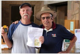

Editor’s note: East County resident Greg Dunne (photo, top left) has achieved the remarkable feat of becoming the first known person to hike completely around the perimeter of Mission Trails Regional Park—all 28.3 miles! Here is his account of the journey.
Story and photos by Greg Dunne
September 18, 2011 (San Diego)--My hike started Friday morning 9/16/11 at 5:30 am. I hiked around the perimeter of Mission Trails Regional Park; this hike to my knowledge has never been attempted or accomplished. I believe that Mission Trails Regional Park is the second largest park in the world within City limits.
The hike was 28.3 miles! The time was nine hours 37 minutes, with two hours of idle time (bird watching, water breaks, and a stop at Mission Trails Visitors Center).
I started out at 5:30 a.m. at Lake Murray. Other times logged: Barker Way Trailhead was reached at 7:34 a.m., at 8.5 miles. Mast Blvd parking area reached at 9:04 a.m., at 13.1 miles. Clairemont Mesa Blvd. trailhead reached at 11:37 am, at 19.3 miles. Regional Park Visitors Center reached at 12:45 p.m., at 22.7 miles. I met with Executive Director Jay Wilson at the center, then finished back at my car at Lake Murray 3:01 p.m.
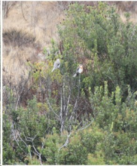
Being an East County boy, born in 1960 at Grossmont Hospital, I really enjoyed the hike. Among the highlights along the way that I saw were a family of four white tailed kites, another family of birds, six California valley quail, and a very handsome, large coyote crossed the path very close to me, maybe only 15 feet away.
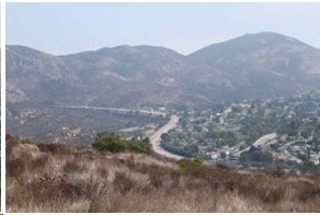
The park includes Lake Murray, Mission Trails Regional Gold Course, Cowles Mountain and Mission Gorge. This was an epic hike for me--and I think I’ll do this on an annual basis!
Below are the details of my hike with map (hike trail in red). Thanks, Dad, for meeting with me at the Visitors Center.
For more information on Mission Trails Regional Park, see www.mtrp.org.
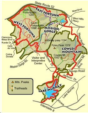
The route
The hike starts at Parkway and Connecticut near Interstate 8, walking up Lake Murray Blvd to the entrance of Lake Murray. Walk around the lake past the ball fields to the end of the path near the dam (3.2 miles at start of lake entrance), then back to the little league ball fields and onto Murray Park Drive. Continue on Murray Park Drive as it turns into Golfcrest Drive.
Turn right on Jackson Dr. and then left on Lake Shore Drive, which turns into Lake Adlon Drive. Stay on Lake Adlon and then turn left on Cowles Mountain Blvd. Take this residential path to get around the golf course. Stay on Cowles Mountain Blvd until the trailhead of Barker Way.
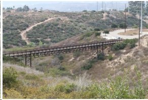
Baker Way trailhead service road took me to Mesa Road Trailhead. Then I followed Mesa Road to Big Rock Park Trailhead and on to Big Rock Road. Big Rock Road leads to Mission Gorge Road and to Mission Trails Regional Park Parking lot off Mast Blvd. Then I took the Grasslands trail to Mariposa Gulch trail and staying on the perimeter trail following the 52 freeway.
I continued on the Rim Trail past the North Fortuna Trail, past Shepherd Pond to Portobelo Drive Trailhead, then on to Clairemont Mesa Blvd. and Calle de Vida Trailhead. Next came Quarry Loop and on to the Visitor Center, then back onto pavement at Mission Gorge Road. From Mission Gorge Road, I headed back to Golfcrest and finished at Lake Murray, entering at the ball fields and finally ending up at Parkway and Connecticut.


Recent comments