
By Miriam Raftery
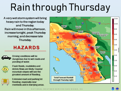
February 13, 2019 (San Diego’s East County) -- A strong atmospheric river storm system with "pineapple connections" (Hawaii origin) will arrive tonight and bring periods of heavy rain late and thunderstorms tonight through Thursday. Mountains could receive 4 to 10 inches of rain, with 2 to 4 inches in valleys and coastal areas and up to an inch in the desert.
The National Weather Service advises that widespread heavy rainfall is expected across the entire area with potential for significant flooding of low lying, poor drainage, and urbanized areas with debris flows possible near recent burn scars. High winds will also be a concern in the mountains and deserts.
Rain will diminish Thursday evening, with lighter showers possible over the weekend. Strong winds could cause damage to trees and property, with strong gust up to 65 miles per hour expected tonight through Thursday in mountains and on desert slope.
Power outages are also possible due to the extreme weather conditions, so be prepared.


Comments
Rain in abundance :-)