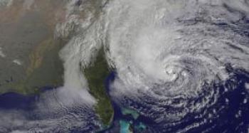
New York may be hardest hit; damage could extend inland as far as the Great Lakes
View live satellite video from NASA: http:/ /www.nasa.gov/mission_pages/hurricanes/main/index.html
October 28, 2012 (San Diego) – San Diegans with relatives and friends in the eastern United States will want to keep watch on the weather. One of the largest tropical cyclones ever in the Atlantic is expected to make landfall tonight and tomorrow along an 800-mile path of the East Coast.
“The system is so large that I would say millions of people are ...in areas that have some chance of experiencing either flash flooding or river flooding,” said Rick Knabb, director of the National Hurricane Center (NHC), CNN reports. The NHC warns that Hurricane Sandy is expected to bring “life-threatening storm surge flooding to the mid-Atlantic coast," though the risk extends hundreds of miles inland.
Portions of New York have been evacuated and all public transportation (subway, bus and rail) will halt at 7 p.m. Schools in low-lying areas of New York, Washington D.C. and other areas will be closed Monday, when the hurricane is expected to strike, bringing storm surge of 6 to 11 feet in New York harbor. A state of emergency has been declared in New Jersey and transportation may be disrupted across the Northeast, officials warn.
The massive storm has already come ashore in the Caribbean, causing at least 65 deaths in Haiti. It is now working its way northward up the Eastern seaboard. Seas of 30 feet off the Carolinas have been observed, AccuWeather.com reports. Numerous roads are underwater in North Carolina’s Outer Banks. Moderate coastal flooding is occurring this morning in portions of Virginia and New Jersey.
Federal officials expected Sandy to create damaging flood and wind conditions across a vast and densely populated portion of the U.S. on the East Coast, and as far west as the Great Lakes.
“We need to make sure people understand that this is going to go well inland,” Craig Fugate, the administrator for the Federal Emergency Management Agency, said in a conference call with reporters, CNN reports. “This is not a coastal threat alone.”
Currently sustained winds of 75 mph have been recorded, with stronger gusts in places. Hurricane-force winds extend outward up to 175 miles and upwards up to 500 miles. The danger could last through Thursday, officials caution.
The powerful storm has also disrupted the campaigns of both President Obama, who is returning to Washington D.C. in anticipation of the storm, and Mitt Romney, who has rescheduled appearances in a storm-targeted region.
For more information visit the National Hurricane Center at http://www.nhc.noaa.gov/.


Recent comments