
By Miriam Raftery
Photos: Alex Tardy, National Weather Service
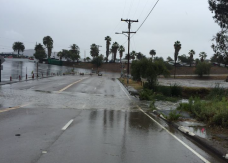
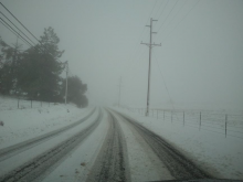
March 11, 2020 (San Diego’s East County) – A pair of storms are forecast to bring heavy rain this week and next, with snow dropping to 3,000 feet by next week. Flash floods, lightning and mudslides may also occur.
The first storm is forecast to bring heavy rainfall this Thursday and Friday to our inland region, with a potential flash flood watch for deserts, valleys and mountains. Rock slides are also possible in mountain areas.
Mountains and deserts could received one to three inches of rain, though the snow level is expected to remain above 7,000 feet in southern California.
A second storm next Monday to Wednesday, March 16-18, will bring cold temperatures, heavy rain, possible thunder showers and lower snow levels down to as low as 3,000 feet, with significant snow accumulation and impacts on travelers possible.


Comments
Weather
The NWS web site says one half of an inch of rain. snow likely but only thirty five degrees. That's not cold enough for much snow.