By Miriam Raftery
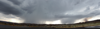
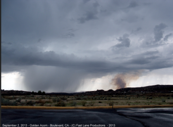
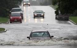
August 25, 2013 (Borrego) --A flash flood watch has been elevated to a flash flood warning today for north and central areas of East County, where heavy rain and flash flooding is occurring. Heaviest rains are from Shelter Valley north to Borrego Springs, including areas burned by the Vallecito Fire and Banner fire.
Debris flows and flooding are occurring in these areas. A SIG ALERT has been issued for Highway 78, which has been shut down in the San Felipe/Monument Valley area, where boulders have washed into the roadway. At Tarantula Wash, one-way traffic controls will remain in effect for several days until roadway repairs can be done, according to the CHP website.
Campgrounds may be impacted by flash floods and debris flows. Excessive runoff will also cause flooding of small creeks, streams, country roads and farmlands nearby.
A flash flood warning remains in effect for a broader area in our local mountains and deserts. Monitor the news to learn if this becomes elevated to a flash flood warning, which means flooding is eminent or occurring.
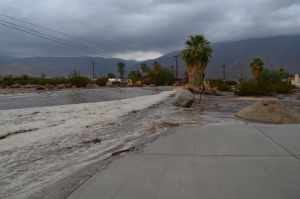
“Today we had the worst flash flooding we have seen in years,” Bob Kutscher, a resident of Borrego Springs on Velite Drive, a main floodway for the Hellhole Canyon watershed wrote in an e-mail to ECM. Here is a video that he shot of the flash flood on his roadway this afternoon: http://www.youtube.com/watch?v=Ky2fhdoiHpA.


 m Raftery
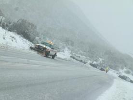

Recent comments