Carveacre

HOMES LOST OVERNIGHT AS VALLEY FIRE SWELLS TO 4,000 ACRES


Update 6:23 p.m. 9/7:  The fire is now 17,345 acres and 3% contained.

Update 9:20 p.m.:  The fire is now 9,850 acres and 1% contained, 11 structures destroyed. Please see updated evacuation map from County of San Diego at sdcountyemergency.com and never hesitate to evacuate if you do not feel safe.

Update 6:55 p.m.   Valley Fire Road Closures are in effect, per CHP tonight:

  • Japatul Road at Lyons Valley Rd/Japatual Valley Road
  • Japatul Road at Tavern Road/Dehesa Road
  • Lyons Valley Road at Honey Springs Road
  • Wisecarver Lane at Wisecarver Truck Trail
  • Skyline Truck Trail and Lawson Valley

Update 4:22 p.m.  The San Diego County Sheriff's Department has issued an evacuation warning for the areas of SR94/Marron Valley Rd and Lyons Valley Rd areas out to Morena Reservoir. Please see the Emergency Map for updated areas that are impacted.

Update 3:35 p.m.  New evacuation advisories include Potrero, Tecate, Barrett Junction and Dulzura. View map here: https://www.sdcountyemergency.com/content/oesemergency/en-us/maps.html.

Per Cal Fire just now:  The fire is now 5,350 acres and is 1% contained, burning at a critical/dangerous rate of spread. Structures are being threatened in Carveacre, Lawson Valley, Wood Valley, Lyons Valley, Deer Horn Valley and Sycuan Indian Reservation. sdcountyemergency.com

Per Pulsepoint:  #ValleyFire is making a run for Barrett Lake, Lake Morena, and Hauser Canyon.

New road closures:  Lawson Valley Rd closed at Skyline TT and Rudnick Dr.   Japatul Rd closed from Dehesa to Lyons Valley Rd   Lyons Valley Rd closed from Japatul Rd to Honey Springs Rd

Update 2 p.m.:  The Valley Fire temporary evacuation point for large animals is the County Animal Services South Shelter located at 5821 Sweetwater Road in Bonita. Call (619) 236-2341.  The evacuation center at Joan MacQueen Middle Schoolm 2001 Tavern Rd., Alpine has reopened. 

By Miriam Raftery

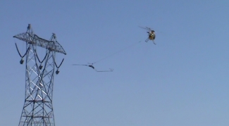
Photo, right by Kathy Matranga


September  6, 2020 (San Diego’s East County) – The #ValleyFire has scorched 4,000 acres, according to Cal Fire’s incident report this morning. Cal Fire San Diego’s Twitter feed reports that 10 structures were destroyed overnight; the blaze is still zero percent contained.

View a map of the fire via NASA satellite imagery.

Road closures:  The San Diego County Sheriff advises that the following road closures are in effect:

  • Japatul Rd. and Carveacre Rd.
  • Lawson Valley Rd. and Skyline Truck Trail
  • Japatul Rd. and Sequan Truck Trail
  • Japatul Rd. and Hidden Glen Rd.

According to the US Forest Service, 335 firefighters are battling the flames on the ground. Structures are being threatened in the Carveacre and Lawson Valley, Wood Valley, Lyons Valley, Deer Horn Valley and Sycuan Indian Reservation.


Error message

Support community news in the public interest! As nonprofit news, we rely on donations from the public to fund our reporting -- not special interests. Please donate to sustain East County Magazine's local reporting and/or wildfire alerts at https://www.eastcountymedia.org/donate to help us keep people safe and informed across our region.

VALLEY FIRE IN ALPINE THREATENS HOMES

Update 5:53 p.m.: The fire is now 1,500 acres. An evacuation order remains in effect for the community of Carve Acre.

Update 5:15 p.m.: Approximately 12,700 customers are without power as a result of the #ValleyFire. The fire is impacting SDG&E equipment in the vicinity of the fire. SDG&E has activated its Emergency Operations Center and is closely monitoring the fire. Additional cool zones are open this weekend (though not after 5pm): https://sdgenews.com/article/additional-cool-zone-hours-added-holiday-we...

Update 5:26 p.m.:  Cal Fire says the wildfire is moving west toward Lawson Valley. Those under evacuation orders can go to Steele Canyon High School at 12440 Campo Road, Spring Valley or Joan MacQueen Middle School at 2001 Tavern Road, Alpine.

Update 4:59 p.m.:  The Valley Fire is now 1,000 acres, per Cal Fire. Temperatures in the Alpine area have soared to 113 degrees.  Scanner traffic indicates a one-mile front on the fire burning toward Lawson Valley. A request for VBAT (very bit air tankers) has been denied due to them battling fires elsewhere.

Update 4:25 p.m.:  The Valley Fire is now 500 acres and zero percent contained. SDG&E's outage map indicates there are some power outages in the fire area. The Lawson Valley area in Jamul is now threatened.

By Miriam Raftery

Photo, left by Kristine Pamintuan, from her home on Japatul Valey Road.

September 5, 2020 (Alpine) – The #ValleyFire is burning westward at a critical rate of spread after starting near 4561 Spirit Trail in the Japatul Valley area of Alpine. The fast-moving brush fire has burned 300 to 400 acres and is threatening homes. Residents of Carveacre are under evacuation orders, the National Forest Service reports.

Multiple fire agencies have responded including air tankers and helicopters. SG&E's Sky Maverick is also doing water drops.

Firefighters are battling the blaze in 105 degree heat with winds 14-28 mph amid a red flag alert and gusty winds.


Error message

Support community news in the public interest! As nonprofit news, we rely on donations from the public to fund our reporting -- not special interests. Please donate to sustain East County Magazine's local reporting and/or wildfire alerts at https://www.eastcountymedia.org/donate to help us keep people safe and informed across our region.

MOUNTAIN LION REPORTEDLY RELOCATED AFTER ATTACKS ON LIVESTOCK IN JAPATUL/CARVEACRE; SECOND LION SEEN IN AREA


By Miriam Raftery

June 1, 2013 (Japatul) – Following a series of attacks on livestock in the Japatul/Carveacre area east of Alpine,  a mountain lion has been captured and relocated by state Fish and Game authorities, according to Lori Briggs.

 However, she indicated that a Fish and Game official advised that “there is a another lion very close.”  Although lions are elusive and rarely seen, residents should be aware and take precautions to protect children and domestic animals in the area.


Error message

Support community news in the public interest! As nonprofit news, we rely on donations from the public to fund our reporting -- not special interests. Please donate to sustain East County Magazine's local reporting and/or wildfire alerts at https://www.eastcountymedia.org/donate to help us keep people safe and informed across our region.

COUNTY EXPANDS BAN ON SUNDAY HELICOPTER FLIGHTS, BUT RESIDENTS COMPLAIN NOISE CONTINUES AS SDG&E PUSHES FORWARD ON POWERLINK

By Miriam Raftery
 

November 6, 2011 (San Diego’s East County) – On Friday, the County Department of Planning and Land Use announced a new amendment to noise variances granted to SDG&E for Sunrise Powerlink construction.


Error message

Support community news in the public interest! As nonprofit news, we rely on donations from the public to fund our reporting -- not special interests. Please donate to sustain East County Magazine's local reporting and/or wildfire alerts at https://www.eastcountymedia.org/donate to help us keep people safe and informed across our region.