San Diego weather

STORM WEDNESDAY TO BRING HEAVY RAINS AND LIGHTNING: FLOODING AND WATERSPOUTS POSSIBLE

Waterspouts possible in coastal areas

East County News Service

Photo: Creative Commons via N.A.

December 3, 2019 (San Diego’s East County) – Thunderstorms Wednesday is expected to bring moderate to heavy rainfall and lightning strikes to our region. Bursts of moderate to heavy rain will raise the threat for street flooding in areas with poor drainage or low lying areas prone to flooding. Rain falling on snow covered or frozen ground could also lead to enhanced runoff and localized flooding in the mountains.

Waterspouts are possible over coastal waters and the National Weather Service’s Skywarn activation may be requested on Wednesday. Surf could reach nine feet along San Diego’s coastline.


Error message

Support community news in the public interest! As nonprofit news, we rely on donations from the public to fund our reporting -- not special interests. Please donate to sustain East County Magazine's local reporting and/or wildfire alerts at https://www.eastcountymedia.org/donate to help us keep people safe and informed across our region.

SNOW FALLING ON I-8, HEAVY SNOW BLANKETS MOUNTAINS AS OTHER AREAS FLOOD

By Miriam Raftery

Photo, left by Robert Scheid:  Snow falls along I-8 near the Sunrise Highway exit

November 28, 2019 (San Diego’s East County) – It’s a white Christmas across East County’s mountains and rural areas. Snow is falling along Interstate 8 east of Alpine.

A blanket of snow covers the Cuyamaca area, Cal Trans reports on Twitter.  In Warner Springs, chains or snow tires are required, with two inches of snow on Chihuahua Valley Road, NBC 7 reports. Snow is heavy in the Julian area, leaving some residents snowed in, sources told ECM.


Error message

Support community news in the public interest! As nonprofit news, we rely on donations from the public to fund our reporting -- not special interests. Please donate to sustain East County Magazine's local reporting and/or wildfire alerts at https://www.eastcountymedia.org/donate to help us keep people safe and informed across our region.

WHITE THANKSGIVING FORECAST FOR MOUNTAINS, FLASH FLOOD WATCH ALSO ISSUED AS “DANGEROUS” WINTER STORM TO IMPACT HOLIDAY TRAVELERS


East County News Service

November 26, 2019 (San Diego’s East County) – A winter storm watch has been issued for the National Weather Service from Wednesday at 4 a.m. through Friday at 10 p.m. for all mountain areas in San Diego County. There is also a flash flood watch for areas west of the mountains from Wed. at 4 a.m. through Thursday at 10 p.m.

Heavy mountain snow will bring hazardous travel conditions Wednesday through Friday, with accumulating snow down to 3,000 feet by Thanksgiving night.  Up to three feet could accumulate above 5,000 feet including Mt. Laguna and Palomar, with several inches at lower elevations.


Error message

Support community news in the public interest! As nonprofit news, we rely on donations from the public to fund our reporting -- not special interests. Please donate to sustain East County Magazine's local reporting and/or wildfire alerts at https://www.eastcountymedia.org/donate to help us keep people safe and informed across our region.

STORMY THANKSGIVING COULD BRING SNOW BELOW 3,000 FEET, THUNDERSTORMS AND HEAVY RAINS ACROSS REST OF REGION

By Miriam Raftery

November 23, 2019 (San Diego’s East County) – If you’re heading over the rivers and through the woods this Thanksgiving week, you might just wind up traveling through white and drifted snow, as the popular song lyrics go—not to mention rain and flash flooding, too, making for hazardous roadway conditions across southern California, the National Weather Service warns.

The National Weather Service predicts a major winter storm will bring significant snowfall of one to two feet above 5,000 feet by Wednesday, with the snow level dropping to 3,000 feet or even lower by Friday.  Snow could impact I-8 through San Diego County’s mountains, as well as areas such as Cuyamaca, Julian, Jacumba Hot Springs, Descanso, Mount Laguna and Palomar Mountain locally, as well as the Cajon Pass on I-15 for those heading north.


Error message

Support community news in the public interest! As nonprofit news, we rely on donations from the public to fund our reporting -- not special interests. Please donate to sustain East County Magazine's local reporting and/or wildfire alerts at https://www.eastcountymedia.org/donate to help us keep people safe and informed across our region.

STORM DOUSES COUNTY

By Miriam Raftery

November 20, 2019 (San Diego) – The first winter storm of the season has dumped snow on Mt. Laguna and Palomar Mountain, also bringing lightning strikes, heavy rainfall and flooding to some parts of San Diego County.

Sheriff Bill Gore tweeted a photo (left) with this message:  “Yes there is a bit of snow on Laguna but it is melting fast and the roads are dangerous. This is not the time for your winter outing.”


Error message

Support community news in the public interest! As nonprofit news, we rely on donations from the public to fund our reporting -- not special interests. Please donate to sustain East County Magazine's local reporting and/or wildfire alerts at https://www.eastcountymedia.org/donate to help us keep people safe and informed across our region.

WINTER STORM TO BRING SHOWERS AND SNOW

By Miriam Raftery

November 18, 2019 (San Diego’s East County) -- The first winter storm will impact southern California Tuesday through Thursday, says Alex Tardy with the National Weather Service.

A cold upper level storm will interact with tropical moisture on Tuesday bringing precipitation. The cold air from this northern stream storm will arrive early Wednesday and allow snow to develop in the mountains.


Error message

Support community news in the public interest! As nonprofit news, we rely on donations from the public to fund our reporting -- not special interests. Please donate to sustain East County Magazine's local reporting and/or wildfire alerts at https://www.eastcountymedia.org/donate to help us keep people safe and informed across our region.

RED FLAG WARNING SUNDAY, BUT RAIN IS ON THE WAY

East County News Service

November 16, 2019 (San Diego’s East County) -- The San Diego National Weather Service has issued a Red Flag Warning for Sunday, Nov. 17 from 1 a.m. to 6 p.m.  for inland valleys and foothills.  Winds of 20-30 mph are forecast, with gusts up to 50 mph and humidity around 10%. 

Rain is possibly by Tuesday, however, with an increasing likelihood of rain Wednesday through Friday.


Error message

Support community news in the public interest! As nonprofit news, we rely on donations from the public to fund our reporting -- not special interests. Please donate to sustain East County Magazine's local reporting and/or wildfire alerts at https://www.eastcountymedia.org/donate to help us keep people safe and informed across our region.

RED FLAG WARNING: STRONGEST SANTA WINDS THIS SEASON

East County Wildfire & Emergency Aerts

October 28, 2019  (San Diego) --- The National Weather Service has issued a red flag alert, warning of extremely critical fire weather conditions arriving Tuesday night and continuing through Thursday afernoon.  This has potential to be the strongest Santa Ana wind event so far this season, the NWS predicts.


Error message

Support community news in the public interest! As nonprofit news, we rely on donations from the public to fund our reporting -- not special interests. Please donate to sustain East County Magazine's local reporting and/or wildfire alerts at https://www.eastcountymedia.org/donate to help us keep people safe and informed across our region.

FIRST FALL FROST WARNING ISSUED; WINDY WEATHER TO RETURN

By Miriam Raftery

October 28, 2019 (San Diego’s East County)—The National Weather Service has cancelled a fire weather watch for Monday in San Diego County, however a stronger Santa Ana Wind event is likely Tuesday through Thursday.

The temperatures are cooling off, however, with freezing temperatures likely across the high desert areas mid-week. Lows could dip into the 20s by Thursday night and Friday morning, says meteorologist Dan Gregoria.


Error message

Support community news in the public interest! As nonprofit news, we rely on donations from the public to fund our reporting -- not special interests. Please donate to sustain East County Magazine's local reporting and/or wildfire alerts at https://www.eastcountymedia.org/donate to help us keep people safe and informed across our region.

SDG&E IS PREPARED FOR SANTA ANA WINDS, WARNS 1,000 BACKCOUNTRY CUSTOMERS OF POTENTIAL SAFETY POWER SHUTOFFS

October 21 (San Diego) -- San Diego’s backcountry is expected to experience Santa Ana winds Monday and Tuesday (Oct. 20-22), winds expected to peak on Monday in the 30-40 miles per hour range.  The utility has warned 1,032 customers that it may need to turn off power for safety in these communities:

  • Boulder Creek
  • Boulevard
  • Cameron
  • Crestwood
  • La Posta
  • Valley Center East
  • Viejas

(A map of the areas that could potentially be affected is posted at sdge.com/ready.)


Error message

Support community news in the public interest! As nonprofit news, we rely on donations from the public to fund our reporting -- not special interests. Please donate to sustain East County Magazine's local reporting and/or wildfire alerts at https://www.eastcountymedia.org/donate to help us keep people safe and informed across our region.

FIRE WEATHER AND WINDY CONDITIONS

By Miriam Raftery

September 19, 2019 (San Diego’s East County) – Gusty winds and low humidity this evening in San Diego’s mountains and deserts combine for elevated fire conditions this evening.  Wind gusts of 25 to 40 miles per hour are forecast.


Error message

Support community news in the public interest! As nonprofit news, we rely on donations from the public to fund our reporting -- not special interests. Please donate to sustain East County Magazine's local reporting and/or wildfire alerts at https://www.eastcountymedia.org/donate to help us keep people safe and informed across our region.

DRY LIGHTNING COULD SPARK FIRES


By Miriam Raftery

September 16, 2019 (San Diego’s East County) – An increased potential for fire starts today in the San Diego region. The National Weather Service is warning the there is a chance of dry lightning, with relative humidity that could fall below 20 percent this afternoon.


Error message

Support community news in the public interest! As nonprofit news, we rely on donations from the public to fund our reporting -- not special interests. Please donate to sustain East County Magazine's local reporting and/or wildfire alerts at https://www.eastcountymedia.org/donate to help us keep people safe and informed across our region.

MORE STORMY WEATHER AND HIGH HEAT ON HORIZON


By Miriam Raftery

Photos: National Weather Service storm images in Campo and El Cajon, plus lightning totals.

July 25, 2019 (San Diego’s East County)  - San Diego County had 145 lightning strikes during a 24-hour period ending at 6 p.m. last night. Thunderstorms doused East County’s mountain and rural areas, producing some dramatic downpours and striking images. 

Even the usually parched desert community of Borrego Springs logged .21 inches in just 10 minutes. Borrego resident Bob Kutscher described the deluge as “BIG loud windblown drops that I thought was hail but ended up being very loud rainfall.”

FORECAST FOR THIS WEEKEND AND NEXT WEEK:


Error message

Support community news in the public interest! As nonprofit news, we rely on donations from the public to fund our reporting -- not special interests. Please donate to sustain East County Magazine's local reporting and/or wildfire alerts at https://www.eastcountymedia.org/donate to help us keep people safe and informed across our region.

FLASH FLOODING AND EXTREME THUNDERSTORM WARNING IN EFFECT

July 24, 2019 (San Diego's East County) -- The National Weather Service has issued a flash flooding and extreme thunderstorm warning for the southeast portions of San Diego County in effect now through 4 p.m.  Locations likely to experience flooding include  Alpine, I-8 Between Pine Valley And Boulevard, Lake Morena, Potrero, Campo, Pine Valley, Descanso, Tecate, Guatay and Barrett  Lake.

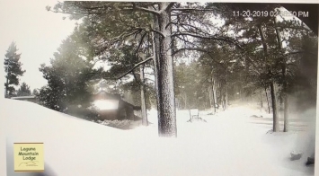
Photo, right: Rainstorm over Boulevard, taken by Donna Tisdale this afternoon

PRECAUTIONARY/PREPAREDNESS ACTIONS:

Excessive runoff from heavy rainfall will cause flooding of small creeks and streams, country roads, farmland, and other low lying  spots.

In hilly terrain there are hundreds of low water crossings which are potentially dangerous in heavy rain. Do not attempt to cross flooded roads. Find an alternate route.


Error message

Support community news in the public interest! As nonprofit news, we rely on donations from the public to fund our reporting -- not special interests. Please donate to sustain East County Magazine's local reporting and/or wildfire alerts at https://www.eastcountymedia.org/donate to help us keep people safe and informed across our region.

WIND ADVISORY TUESDAY AFTERNOON AND WEDNESDAY MORNING

East County News Service

April 2, 2019 (San Diego)--The National Weather Service has issued a wind warning in effect from noon today to 11 a.m. tomorrow for San Diego’s mountain and desert areas.  Southwest winds of 20-30 miles per hour with gusts up to 60 mph are forecast.

Watch for blowing dust or sand in these areas and use caution if driving a high-profile vehicle.


Error message

Support community news in the public interest! As nonprofit news, we rely on donations from the public to fund our reporting -- not special interests. Please donate to sustain East County Magazine's local reporting and/or wildfire alerts at https://www.eastcountymedia.org/donate to help us keep people safe and informed across our region.

WINTER WEATHER ADVISORY: SNOW AT HIGH ELEVATIONS TODAY AND TOMORROW

East County Wildfire & Emergency Alerts

March 11, 2019 (San Diego) – A winter weather advisory from the National Weather Service is in effect from 3 p.m. today until 12 noon tomorrow.  Snow is forecast above 5,500 feet in mountain areas of San Diego, San Bernadino and Riverside Counties.


Error message

Support community news in the public interest! As nonprofit news, we rely on donations from the public to fund our reporting -- not special interests. Please donate to sustain East County Magazine's local reporting and/or wildfire alerts at https://www.eastcountymedia.org/donate to help us keep people safe and informed across our region.

SNOW, ICE SHUTS DOWN I-8 AT ALPINE; SNOW BLANKETS MOUNTAIN AREAS


Update 10:38 a.m.  -- CHP is now escorting vehicles on I-8 between Alpine and the county line. Expect delays.

February 22, 2019 (San Diego's East County) -- East County's mountain areas look like winter wonderlands, with two feet of snow atop Mt. Laguna and several inches or more in Julian (photo, left, webcam in downtown Julian). 

But winter conditions have wreaked havoc with motorists. After many vehicles incuding a semi-truck and a school bu skidded on icy conditions along Interstate 8, authorities shut down I-8 from Alpine to the County line last night. It remains closed this morning, though the CHP has been escorting stranded motorist through the area. 


Error message

Support community news in the public interest! As nonprofit news, we rely on donations from the public to fund our reporting -- not special interests. Please donate to sustain East County Magazine's local reporting and/or wildfire alerts at https://www.eastcountymedia.org/donate to help us keep people safe and informed across our region.

LOW SNOW TONIGHT COULD DIP TO 1,500 FEET

East County News Service

Photo: Rare winter snowfall in Ramona in 2011, by Mike Mulligan

February 20, 2019 (San Diego's East County) -- A storm tonight coupled with a cold front is forecast to drop snow as low as 1,500 to 2,500 feet, the National Weather Service predicts. That could mean rare snowfalls in Ramona, Alpine, or even atop Cowles Mountain.  At higher elevations, 2 to 5 inches are forecast above 3,000 feet in areas such as Julian and Descanso, 6 to 12 inches above 5,000 feet including Mount Laguna and Palomar Mountain, and  12 to 16 inches above 6,500 feet including Cuyamaca Peak.

The storm is expected to bring rainfall of .25 to 1 inch to San DIego County's coastal and desert areas. A frost warning has been issued for Thursday and Friday morning.


Error message

Support community news in the public interest! As nonprofit news, we rely on donations from the public to fund our reporting -- not special interests. Please donate to sustain East County Magazine's local reporting and/or wildfire alerts at https://www.eastcountymedia.org/donate to help us keep people safe and informed across our region.

VALENTINE’S DAY STORM BREAKS RECORDS


By Miriam Raftery

February 15, 2019 (San Diego’s East County) – Yesterday’s Valentine’s Day storm dropped 10.10 inches of snow on Palomar Mountain, breaking a record of 9.58 inches set way back in 1901. The storm also brought sweet relief to drought-stricken Borrego Springs, dropping 2.68 inches of rain on the desert community.  Other new records included Ramona with 4.02 inches, Campo with 3.75 inches, and Alpine with 2.94 inches.

Lillian Trautman of El Cajon sent in the video above, showing her El Cajon yard turned into a rushing torrent of water.


Error message

Support community news in the public interest! As nonprofit news, we rely on donations from the public to fund our reporting -- not special interests. Please donate to sustain East County Magazine's local reporting and/or wildfire alerts at https://www.eastcountymedia.org/donate to help us keep people safe and informed across our region.

SNOW BLANKETS EAST COUNTY MOUNTAINS

By East County Magazine

Photos: Laguna Mountain Lodge Faceboko page

February 6, 2019 (Laguna Mountain) – Five days of storms have blanketed local mountains including Mount Laguna with up to a foot of snow, the National Weather Service reports. Julian, Pine Valley and Descanso all received snow.  The storm also doused much of the county with heavy rains, including up to six inches in some locations.

If you’re considering a trip to frolic in the snow, check current road and weather conditions since tire chains may be required, and use caution on icy roads. Also check these resources:


Error message

Support community news in the public interest! As nonprofit news, we rely on donations from the public to fund our reporting -- not special interests. Please donate to sustain East County Magazine's local reporting and/or wildfire alerts at https://www.eastcountymedia.org/donate to help us keep people safe and informed across our region.

WINTER STORM WARNING: SNOW DOWN TO 2500 FEET TONIGHT

East County News Service

February 4, 2019 (San Diego’s East County) – The National Weather Service has issued a winter storm warning in effect now through 4 a.m. Wednesday for heavy snow in the mountains of San Diego’s East County. 

The snow level could dip down to 2500 to 3500 feet, with six to 12 inches of snow above 4500 to 5000 feet.


Error message

Support community news in the public interest! As nonprofit news, we rely on donations from the public to fund our reporting -- not special interests. Please donate to sustain East County Magazine's local reporting and/or wildfire alerts at https://www.eastcountymedia.org/donate to help us keep people safe and informed across our region.

NEW STORMS TO BRING HEAVY RAIN, WINDS UP TO 80 MPH THIS WEEKEND

East County News Service

February 1, 2019 (San Diego's East County) -- A powerful storm is forecast to bring heavy rains and powerful winds countywide tonight through Saturday night, according to the National Weather Service. 

The storm could bring up to 4 inches of snow in mountain areas and a half inch in deserts, with 1.25 inches forecast in inland valleys and the coast. Strong winds with gusts up to 70 or 80 miles per hour in mountain and deset passes are also forecast, so secure loose items such as patio umbrellas. 

Flash flooding, urban flooding and debris flows are possible in some areas.

Another storm is expected to reach our region Sunday morning, with lighter rainfall Sunday and Monday.


Error message

Support community news in the public interest! As nonprofit news, we rely on donations from the public to fund our reporting -- not special interests. Please donate to sustain East County Magazine's local reporting and/or wildfire alerts at https://www.eastcountymedia.org/donate to help us keep people safe and informed across our region.

STORM SYSTEM SWOOPS INTO REGION BRINGING HEAVY RAIN, SNOW AND WAVES UP TO 14 FEET


East County News Service

January 11, 2019 (San Diego’s East County) – Heavy rain and snow is forecast to fall starting tonight, with several new storm systems from the Pacific northwest slated to reach our region next week.

According to the National Weather Service, tonight and tomorrow morning should bring a half inch of rain west of the mountains and up to an inch or rain in the mountains, with several inches of snow above 6,000 feet including Palomar Mountain. Be prepared for a brief period of very heavy rain and strong surf.


Error message

Support community news in the public interest! As nonprofit news, we rely on donations from the public to fund our reporting -- not special interests. Please donate to sustain East County Magazine's local reporting and/or wildfire alerts at https://www.eastcountymedia.org/donate to help us keep people safe and informed across our region.

WEEKEND STORM TO BRING MORE RAIN AND SNOW


East County News Service

January 4, 2019 (San Diego's East County) -- A new storm is heading to our region.  The National Weather Service predicts rain and snow down to 5,000 feet elevation late Saturday and Sunday.


Error message

Support community news in the public interest! As nonprofit news, we rely on donations from the public to fund our reporting -- not special interests. Please donate to sustain East County Magazine's local reporting and/or wildfire alerts at https://www.eastcountymedia.org/donate to help us keep people safe and informed across our region.

FREEZING TEMPERATURES, HIGH WINDS START OFF THE NEW YEAR


By Miriam Raftery

East County News Service

December 31, 2018 (San Diego's East County) -- Frost and freeze warnings and watches are in effect for much of our region tonight through Thursday, with snow levels forecast to dip down to 3,500 feet. Temperatures could fall as low as 25 degrees in some East County mountain and desert areas – cold enough to freeze pipes and sensitive plants. High winds are also forecast across inland valleys, with gusts up to 75 miles per hour.

Light showers and snowfall fell at higher elevations today, with additional precipitation expected through 10 p.m. tonight and icy roads likely.


Error message

Support community news in the public interest! As nonprofit news, we rely on donations from the public to fund our reporting -- not special interests. Please donate to sustain East County Magazine's local reporting and/or wildfire alerts at https://www.eastcountymedia.org/donate to help us keep people safe and informed across our region.

RAIN, STRONG WINDS FORECAST OVER CHRISTMAS: SNOW POSSIBLE AT HIGH ELEVATIONS

By Miriam Raftery

December 22, 2018 (San Diego’s East County) – Two storms are forecast to bring strong winds up to 60 mph, chilly temperatures and rain to our region starting Tuesday, Christmas morning, through Friday. Light snow may fall above 5,000 feet, with up to two inches of snow potentially bringing a whtie Christmas atop Mount Laguna and Palomar Mountain, our region’s highest peaks.


Error message

Support community news in the public interest! As nonprofit news, we rely on donations from the public to fund our reporting -- not special interests. Please donate to sustain East County Magazine's local reporting and/or wildfire alerts at https://www.eastcountymedia.org/donate to help us keep people safe and informed across our region.

DELUGE DOUSES REGION, BUT SUNNY SKIES RETURN


By Miriam Raftery

Photo by Robert Gehr, left:  El Cajon Library closed temporarily due to flooding.

December 7, 2018 (San Diego’s East County) – Storms over the past two days brought much needed rain to our region, up to 3 inches in some areas.  But the downpour also causing flash flooding in many areas.

Several cars became caught up in rushing water up to four feet in southeast county, where major flooding occurred on Otay Lakes Road by Pio Pico RV Park and also on Highway 94 between the Jamul Casino and Jamul Estates.  Jan Hedlun, a motorist delayed due to the flooding, says  that 45 minutes after Cal Trans closed the highway, “There was no one directing traffic or telling stranded travelers to turn around and find another way home, as there has been during priori events. “No signs were being posted to prevent people from coming down Highway 94.” She asks why CHP or Border Patrol agents were not brought in to assist and why funding has not been allocated to fix the roads/drainage in these two recurring trouble spots.

In El Cajon, the County Library is closed today due to damage inside caused by flooding. 

Thunder, lightning and power outages also occurred across the region due to the storm.


Error message

Support community news in the public interest! As nonprofit news, we rely on donations from the public to fund our reporting -- not special interests. Please donate to sustain East County Magazine's local reporting and/or wildfire alerts at https://www.eastcountymedia.org/donate to help us keep people safe and informed across our region.

FLASH FLOOD WARNINGS AND WATCHES ISSUED

December 6, 2018 (San Diego) -- The National Weather Service has issued flash flood watchings, warnings and advisories across our region. A flash flood warning, the most severe alert, is in effect now through 8:30 p.m. for  Chula Vista, Descanso, El Cajon, National City, La Mesa, Poway, Imperial Beach, Ramona, Coronado, Alpine , portions of the San Diego city  limits, and Mission Valley.  An advisory is in effect for a broader area spanning the entire county from coasts to deserts.

Thunderstorms are producing heavy rain across the warned area.  A half to nearly an inch of rain has already fallen with another inch or more expected. 

Do not attempt to drive across a flooded roadway and stay indoors during thunder and lightning.


Error message

Support community news in the public interest! As nonprofit news, we rely on donations from the public to fund our reporting -- not special interests. Please donate to sustain East County Magazine's local reporting and/or wildfire alerts at https://www.eastcountymedia.org/donate to help us keep people safe and informed across our region.

STORM FORECAST


East County News Service

October 12, 2018 (San Diego)-- A storm is forecast to bring rain across our county tonight through Saturday night.  Rainfall will be heaviest over the mountains with thunderstorms predicted.


Error message

Support community news in the public interest! As nonprofit news, we rely on donations from the public to fund our reporting -- not special interests. Please donate to sustain East County Magazine's local reporting and/or wildfire alerts at https://www.eastcountymedia.org/donate to help us keep people safe and informed across our region.

RED FLAG WARNING THROUGH TUESDAY: POTENTIAL FOR "EXTREME FIRE BEHAVIOR"


East County News Service

August 6, 2018 (San Diego’s East County) – The National Weather Service has issued a red flag alert in effect from 4 p.m. today through 9 p.m. Tuesday for all of San Diego County and much of Southern California. 

“.If fire ignition occurs, conditions are favorable   for very rapid fire spread including long range spotting, and  extreme fire behavior which would threaten life and property,” the NWS warns.

Those conditions include strong winds, dry fuels and hot, dry weather. Triple digit heat is forecast inland.


Error message

Support community news in the public interest! As nonprofit news, we rely on donations from the public to fund our reporting -- not special interests. Please donate to sustain East County Magazine's local reporting and/or wildfire alerts at https://www.eastcountymedia.org/donate to help us keep people safe and informed across our region.

Pages