
Weather
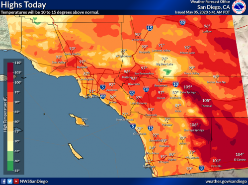
EXTREME HEAT AND FIRE RISK FORECAST FOR LABOR DAY WEEKEND
 By Miriam Raftery
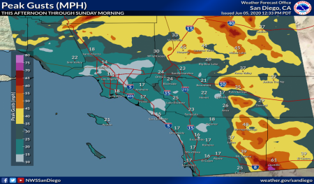
WILD WEATHER CONTINUES: THUNDERSTORMS, FLASH FLOODS AND HIGH HEAT

FLASH FLOOD WARNING: DANGEROUS THUNDERSTORMS THIS AFTERNOON

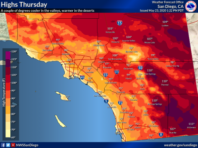
HEAT WAVE SMASHES RECORDS
 By Miriam Raftery
THUNDERSTORMS POSE RISK OF LIGHTNING FIRES AS DANGEROUS HEAT WAVE CONTINUES THIS WEEK
 By Miriam Raftery
COOL ZONES OPEN ACROSS EAST COUNTY DUE TO HIGH HEAT

EXCESSIVE HEAT WARNING

ROLLING BLACKOUTS ACROSS COUNTY: BE PREPARED

EXCESSIVE HEAT WARNING ISSUED FOR DESERTS
 East County News Service
FOURTH OF JULY WEEKEND FORECAST: FIRE WEATHER AND RIP CURRENTS

AS WEATHER HEATS UP, COUNTY OPENS COOL ZONES -- AND OFFERS FREE FANS FOR THOSE HOMEBOUND WITHOUT AIR CONDITIONING
 By Miriam Raftery
WIND ADVISORY IN EFFECT NOW; FIRE WEATHER STARTING SUNDAY
HEAT WAVE MAY BREAK RECORDS THIS WEEK
 By Miriam Raftery
"DANGEROUS" HEAT WARNING FOR DESERT, HEAT ADVISORY FOR INLAND VALLEYS ALL WEEK
RESIDENTS URGED TO TAKE PRECAUTIONS DURING HEAT
 By
By PROPERTY OWNERS WITH RAIN DAMAGE ASKED TO COMPLETE SURVEY
 By
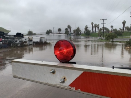
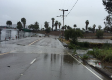
By SAN DIEGO RIVER CRESTS AT 12.5 FEET AS RAINS DOUSE REGION
 By Miriam Raftery
 FLASH FLOOD WARNING FOR CENTRAL SAN DIEGO COUNTY UNTIL 11:30 AM

STORMS TO IMPACT REGION
 East County News Service
STORMS TO BRING RAIN, COLD AND SNOW DOWN TO 4,000 FEET

TWO NEW STORMS TO BRING FLASH FLOOD RISKS AND SNOW TO OUR INLAND REGION
FREE SANDBAGS FOR THE STORM
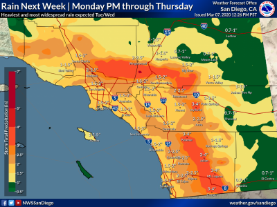
 Source: County News Service
“ATMOSPHERIC RIVER” TO DRENCH REGION MONDAY THROUGH THURSDAY
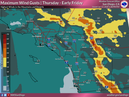
DANGEROUS HIGH WINDS, WEATHER SERVICE WARNS

COLD STORM, FREEZING TEMPERATURES AND HIGH WINDS TO IMPACT REGION

SANTA ANA WINDS AND WARMER WEATHER FORECAST TODAY THROUGH FRIDAY

WATCH FOR WINDY WEATHER
 East County News Service
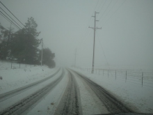
HIGHWAYS CLOSED DUE TO SNOW
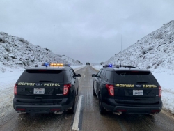
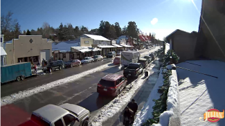 By Miriam Raftery
MAJOR WINTER STORM TO SOCK REGION OVERNIGHT

WINDS HOWLED, RAINS COMING
 East County News Service


Recent comments